Local Walks Near To Carsington Reservoir and Ashbourne. Enjoy walks around local Derbyshire villages near to the beautiful open waters of Carsington
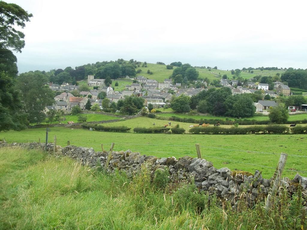
Breath taking views are to be found on this splendid walk which visits the ancient villages of Carsington and Brassington, once the homes of very active lead mining communities. On the moorland route between the two villages there is plenty of evidence of the efforts of miners to extract lead from underneath th earth. At Nickalum Mine in particular, spoil heaps long since grassed over, are to be seen in plentiful supply. The Tudor House, built in 1615, is probably Brassington’s oldest house. At one time it housed paupers for the Ashbourne Poor Law Union; seventy–seven names were recorded at one stage. The men were provided with work, breaking stone in to specific sizes at the rear of the house. There were people living in the area in pre–historic times. Remains of Bronze and Iron Age man have been found at Harborough Rocks, which are near The High Peak Trail, a converted railway line.
WALK DETAILS
Length: 5 miles.
Start/Finish: Carsington Water Sheepwash Car Park.
Location: Off B5035 Wirksworth to Ashbourne road.
Terrain: Steady ascents and one particularly steep descent.
THE ROUTE
1. Leave the car park at the top right-hand edge and walk along the path towards the bird hide. Ignore the next sign for the bird hide and carry straight on to reach the B5035.
2. Cross the road and walk up the track in front of you, keeping straight on before descending and bearing to the left by the school.
3. Walk up the lane passed the village green to the road, continue straight ahead, and where the road swings left, go up the lane marked ‘No through road.’
4. The lane eventually turns into a track curving to the right up to a gate and stile, after which you leave the track to climb a path through a narrow ‘V’ shaped limestone cutting to the top of the hill.
5. Continue through the footings of an old wall on the left by a redundant stile and then through a gap in the wall ahead. You now descend across two stiled fields, aiming about 50 yards to the left of a stone barn.
6. Go over a rough track and follow the winding path up the hill towards the remains of Nickalum Mine before taking the waymarked sign to the left round the old workings, and then bear right through a cutting.
7. The path now descends steadily to a stile near a thorn tree and then follows the wall on the left until another stile is reached.
8. Go over the stile and down the field. At the next stile, turn right before going through two more fields to reach the main road by a farm access into Brassington.
9. Turn left, and within a few yards, right up Miners Hill and then take the first right turn.
10. Go left at the ‘T’ junction and at the edge of the village take the ‘No through road’ sign on the right.
11. When the road ends, go left by a gate and follow the path round some old lead mine workings and then, keeping close to the wall on the right, proceed to Manystones Lane and turn right.
12. Just past some factory buildings take the footpath on the left to reach The High Peak Trail – take a detour here by turning left to visit Harborough Rocks before retracing your steps and continuing along the trail in an easterly direction.
13. Close to a gate across the track cross the stile to the right by Viaton Works, going over a short field to the road and another stile onto Carsington Pasture.
14. Follow the path alongside the wall onto the top of the pasture, before leaving the wall and descending steeply to the right to a small waymarked gate into a back garden.
15. Go down a flight of steps and a lane and turn left, from where you can easily retrace your steps back to the start of the walk.
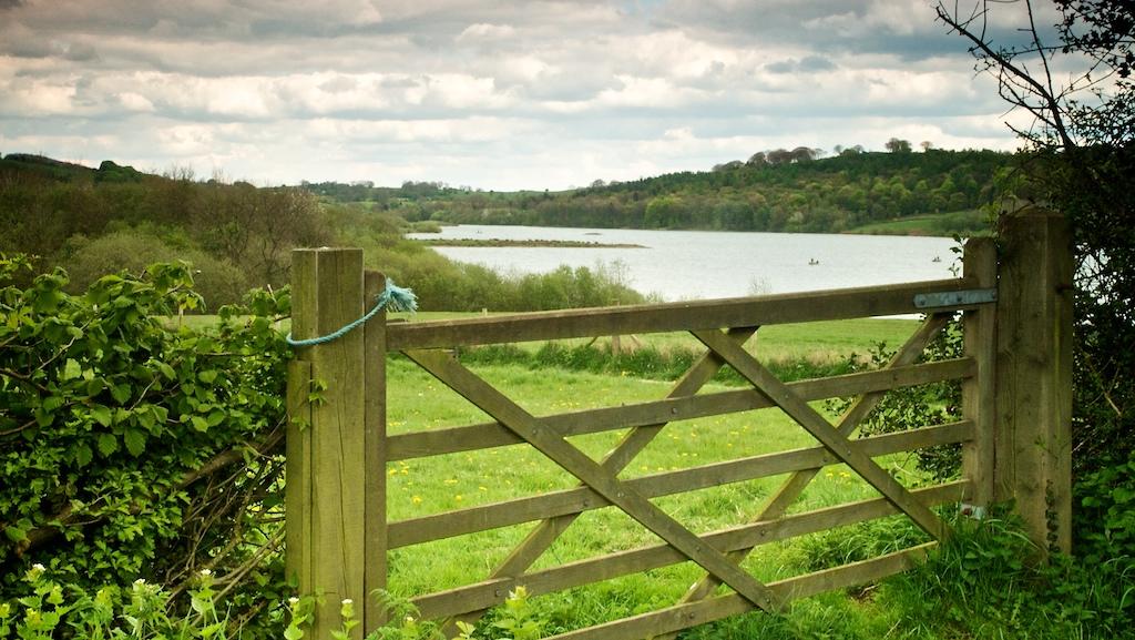
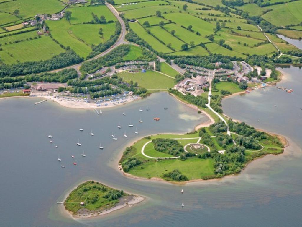
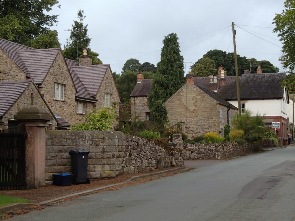
A delightful walk round Carsington Water, one of Derbyshire’s most important tourist attractions since it was opened by HM the Queen in 1992. It is an area noted for its wildlife, with a Wildlife Centre and bird hides en route. The reservoir built at a cost of £107 million increased Severn Trent’s raw-water capacity by 10% to meet the growing demand for water in Derbyshire, Nottinghamshire and Leicestershire. Water is first pumped from the River Derwent at Ambergate Pumping Station. It is piped to Carsington Water when the river level is high and stored in the reservoir and released when the river is dry. Severn Trent has planted half a million trees and shrubs in woodlands, copses and hedgerows; the result has been not only to enhance a beautiful landscape, but to create many new habitats for wildlife. The walk visits the attractive conservation villages of Carsington and Hopton. They are inseparably linked and lie in a wooded valley with Carsington Pasture rising steeply to one thousand feet to the west, behind a row of attractive little cottages that line the roadside. Both villages share the same church and school. The houses in each village almost overlap on the shared narrow road, and they are both in the same parish.
WALK DETAILS
Length: 8.5 miles.
Start/Finish: Visitor Centre at Carsington Water.
Location: On the south side follow the signs from the A517 Ashbourne to Belper road, and on the north from the B5035 Ashbourne to Wirksworth road.
Terrain: Easy relatively level walking on good paths through fields and woodland alongside the reservoir. There is no pavement on the section from Carsington to Hopton.
THE ROUTE
1. From the Visitor Centre, walk southwards and follow the path past the sailing club, to pick-up footpath signs for Millfields.
2. Continue along the dam wall, at the far end of which you follow the main path to Millfields. Cross the car park, in front of the refreshment kiosk – open on a seasonal basis.
3. Follow the path close to the edge of the reservoir, and after crossing a long footbridge take the footpath on the left with the yellow sign indicator (when there is an option – follow the yellow signs).
4. On reaching a narrow tarmac lane by Upperfields Farm, turn left for a few yards and then right at a gate to follow a path signed for Hopton.
5. The path winds up and down through pasture and woodland, before reaching a gate leading onto the B5035. At this point turn left, with the wall on your right. After 35 yards turn right and cross the road OR continue with the new path along the reservoir which now takes you to the Sheepwash carpark.
6. Follow the path opposite, which leads you up to the road through the village of Hopton.
7. Turn left and follow the road through Hopton to the adjoining village of Carsington. Take care - there is no pavement on this section of the walk.
8. Immediately after passing the Miners Arms Public House, turn left at a fingerpost sign and then left again to walk down the lane at the rear of the pub.
9. Before reaching the school, turn right up a lane and continue straight on when it forks.
10. The lane ends at the B5035, which you cross and follow the path straight ahead for a short distance before bending to the left and then right.
11. Walk across Sheepwash Car Park and follow the distinct path ahead.
12. Keep to the main path, close to the reservoir, past Carsington Wildlife Centre, back to the starting point of the walk.
TOP TIP
You can walk to Carsington Water from the cottages in about 5-10 minutes. From the bottom of the driveway turn right and walk up the roadside for approx. 100 yards until you see a gate on the opposite side of the road. Cross over here which takes you onto a path behind the Pudding Room, half way to Carsington the path ends and you will need to cross over the road on to another path and this will take you the rest of the way to Carsington Water.
Outstanding views and fascinating places to visit, this walk reveals much of the heritage of this upland area. There are many strange rock formations found in the area at Rainster Rocks and Hipley Hill, the countryside surrounding Brassington being of considerable interest to the geologist, the botanist and the climber. After leaving Brassington behind, the unusual rock formations of Rainster Rocks, an example of dolomitic limestone, are soon reached. Harborough Rocks further on in the walk, where the remains of Bronze and Iron Age man have been found, are similar in formation. Longcliffe, on the dry limestone moorlands, was an important watering point in the days when the Cromford and High Peak Railway was in operation. The railway was considered to be an engineering masterpiece. It linked High Peak Junction at 277 feet above sea level with Whaley Bridge at 517 feet, rising in the middle to over 1,000 feet. The track has now been converted into the High Peak Trail. After leaving the trail at Harborough Rocks, an extensive area where lead miners used to work is passed.
WALK DETAILS
Length: 5.5 miles.
Start/Finish: Wirksworth Dale Car Park.
Location: Between the B5056 Ashbourne to Bakewell road, and the B5035 Ashbourne to Wirksworth road.
Terrain: A short climb out of Brassington, but generally easy going along moorland paths, quiet country roads and the High Peak Trail.
THE ROUTE
1. From the car park, walk down Wirksworth Dale and turn left at the bottom of the road towards Brassington.
2. Turn right by the Village Hall and follow the narrow lane round to the right. At a crossing point of lanes, continue ahead along a lane with walls on either side.
3. A few yards past the church, go over a stile on the right into a field (public transport users should walk to the church and go through the gate on the far left side. Then follow the path close to the church wall up to the lane referred to above. Turn left and then right into the field mentioned previously.)
4. Angle to the left to climb up the field, but it soon levels out, before reaching a stile in the wall on the far side of the field.
5. Turn half right across the next field, but before arriving at the far side the path bends further to the right leading to a stile onto a farm lane.
6. Do not cross the stile opposite, but walk down the lane for a short distance, before going over a stile on the right.
7. Rainster Rocks are now clearly in view and you should angle to the left down the field to join a grass track heading in the direction of the rocks.
8. Follow the track past a small outcrop of rocks and turn left to go over a stile in the wall, and walk to a footpath marker post a few yards ahead.
9. From here, you can continue straight ahead to explore Rainster Rocks, before returning to the same marker post. You then head back across the field to a stile to the north of the one you previously crossed.
10. Do not cross the stile, but walk alongside the wall, past a barn and down a cart track to reach a minor road.
11. Turn right and carefully follow the road towards Longcliffe - 50 yards after passing under the High Peak Trail Bridge, go to the right along a surfaced track and then turn left down the trail.
12. Follow the High Peak Trail for one and a half miles. You can then go to the left to explore Harborough Rocks, before retuning to the same point and turning right immediately after passing an industrial plant.
13. On reaching Manystones Lane, turn right and after about 300 yards go over a stile in the corner of a field on the left.
14. Head across the field, keeping close to the field boundary as it bends its way round, eventually arriving at a stile in the far left hand corner.
15. Turn right and walk down the lane to the car park and picnic site (public transport users should walk to the bottom of the lane and turn left to reach Brassington.)
An easy walk through pleasant countryside with excellent views over Carsington Water one of Derbyshire’s newest and most popular tourist attractions. The walk along the dam wall affords good views over the reservoir, often busy with sailing craft, particularly at weekends and during the summer.
After visiting the attractive little village of Hognaston the route climbs steadily through a series of fields to Upper Town, before visiting the Knockerdown Inn which in 2000 won the prestigious Family Pub of the Year award.
The view over Carsington Water, where Severn Trent has planted half a million trees and shrubs in woodlands, copses and hedgerows is stunning. A wide range of wildlife has been attracted to the area and a visit to the Carsington Wildlife Centre should not be missed.
WALK DETAILS
Length: 4 miles.
Start/finish: Carsington Water Visitor Centre.
Location: Off B5035 Ashbourne to Wirksworth road from the north and off the A517 Ashbourne to Belper road to the south.
Terrain: Undulating ground but very wet in places.
WALK DETAILS
1. From the Visitor Centre Car Park follow the signed path to Millfields passing the sailing club on the way and walking along the dam wall.
2. As Millfields is approached keep to the right going through a gap in the bushes to reach an opening in the fence, cross the road and walk down the service road opposite.
3. Follow the winding road down the hillside to join a gravelled path leading past some Severn Trent settlement tanks on the right.
4. Continue along the track until at the bottom of a dip turn left through a gate up a tree lined path with a stream on the left.
5. Go right at the top into a lane and follow it round past a ford and several cottages to the main road through Hognaston.
6. Turn right up the street past the Red Lion to take the second footpath sign on the right by a house named Longacre. The path bends back behind the houses before following the hedge down a field to cross a stile close to the right corner.
7. Continue up the field going through a stile near the top corner on the right and through the gateway on the right in the next field.
8. Now keeping quite close to the hedge on the left go up the field to cross a stile. Still keeping close to the hedge continue up the next field until it widens where you carry straight on to a stile.
9. In the next field aim to the right of an electricity pylon to a stile by a gateway, turn right down a rough track to the ‘old road.’
10. The path to the Knockerdown Inn continues straight ahead to the Hognaston By-pass, across two further fields before returning by the same route to the ‘old road’.
11. Walk down the ‘old road’ and within about 100 yards of joining the by-pass turn left at a stile by the side of the road.
12. Angle to the right across two fields and then keeping close to the fence on the right cross two more fields to go over a stile in the bottom right hand corner.
13. Turn left along the gravelled track for a few yards and then fork right to the Carsington Water Wildlife Centre.
14. Retrace your steps back along the track to the Visitor Centre.
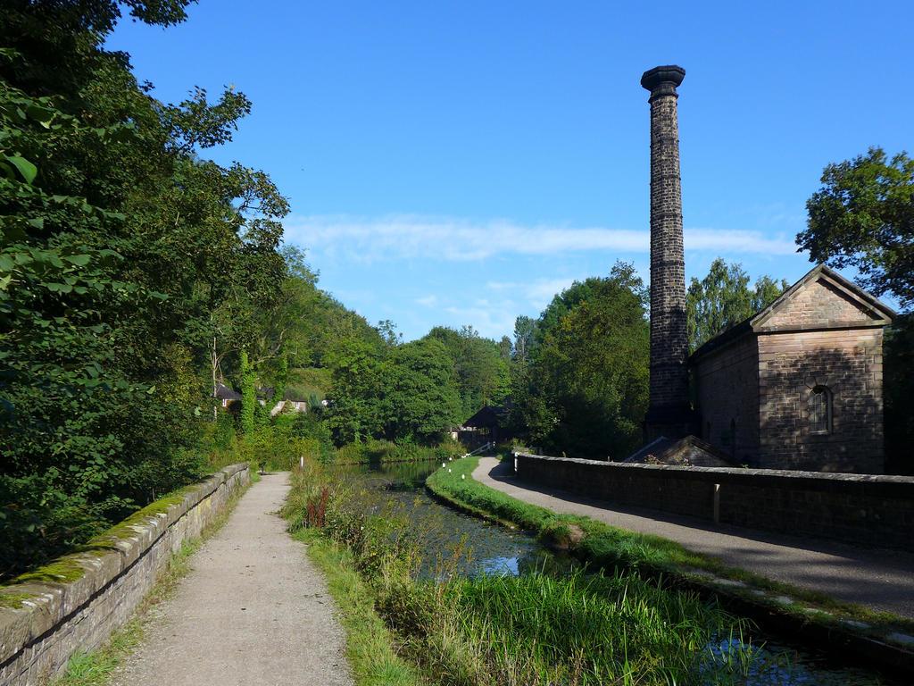
Beautiful scenery, an abundance of wildlife, and world renowned heritage make this walk a very special one. The Derwent Valley having been awarded World Heritage Status in 2001. From Cromford Wharf, where there are a number of interesting canal buildings, follow the towpath for one and a quarter miles. Large numbers of butterflies and dragonflies can be seen in summer with numerous species of birdlife overhead. On reaching High Peak Junction, there is a collection of interesting old railway buildings to inspect. At the foot of High Peak Trail is a catch pit, where runaway wagons once came to rest. North Street in Cromford contains some of the finest examples of Industrial Archaeology in England. The mid – nineteenth century water wheel in Water Lane still operates and the Mill Pond can be admired as you walk down Scarthin to the Market Place. Here stands the historic Greyhound Hotel, built by Sir Richard Arkwright, together with a collection of interesting shops. A visit to the Arkwright complex to discover how Cromford became known as the ‘Cradle of the industrial revolution’ should not be missed.
Length: 3.5 miles.
Start/finish: Cromford Wharf Car Park, take signs for Arkwright Mill.
Location: On A6 two miles south of Matlock.
Terrain: Mostly flat with one incline and descent. Muddy in places.
THE ROUTE
1. The walk starts at Cromford Wharf Car Park, going to the left along the towpath of Cromford Canal.
2. In one and a quarter miles High Peak Junction is reached where you cross the canal walking between the old railway buildings to ascend the High Peak Trail.
3. After one third of a mile turn to the left where you see a footpath signed for ‘Alderwasley’ and after a few yards left again through the tunnel which takes you back under the trail you just walked over.
4. Continue down the lane towards Cromford and shortly after reaching a row of houses on your right, just before Castle View Drive, take the footpath sign on the left.
5. Follow the stiled path keeping close to the fence, passing to the left of a derelict barn to reach a farm lane. Go up the lane to join Barnwell Lane on the right.
6. Take the first turn right down Bedehouse Lane, and follow it round to the main road to turn right and then first right again into North Street.
7. At the end of the street, opposite the school, the path leads off to the left and within 20 yards go through a gap in the wall past a very large circular sluice to reach the main road again.
8. Cross the road and go up Water Lane (A619) turning right just past the waterwheel following the road round as it bends to the right down Scarthin, soon to re-join the main road.
9. Turn left and walk down to the traffic lights to cross the A6 and go down Mill Lane opposite, walking under the cast iron aqueduct once used by the mill (accidentally demolished by a lorry and may be beyond repair).
10. Go left to visit the Arkwright Mill Centre leaving through the Mill Car Park, crossing the road and turning to the left back to the start of the walk.
Starting on the Tissington Trail, the walk visits the pretty village of Mapleton (also spelt Mappleton) before crossing the River Dove into lovely Okeover Park. After leaving the park it climbs gently up in stages
towards Upper Mayfield and then descends to cross Hanging Bridge and returns alongside Bentley Brook. Ashbourne is the starting point of the Tissington Trail, but your stay on it is only brief. The path soon takes to the fields and after a short climb drops down to Mapleton, which is an old red brick village with a beautiful parish church dating back to the 18th century. The Manor House overlooking the water meadows is another pleasing red brick building, which contrasts with the stone of the Peak. A road with open fields crosses Okeover Park, inhabited by a large flock of sheep who sometimes decide to have a sleep on the road! The hall, in attractive red brick, stands well away from the road through the park,
and is well over 200 years old. Lowes Cottage, in Hollow Lane at Upper Mayfield, made national news recently when it was claimed to be haunted. A narrow lane leads down to the River Dove and the walk continues over the flood embankment, alongside Bentley Brook and through fields to the starting point.
WALK DETAILS
Length: 5.25 miles.
Start/Finish: Tissington Trail Car Park.
Location: Heading out of Ashbourne, turn left along Union Street at the top of the Market Place and
follow the road round to the right and keep straight on at the cross-roads towards Mapleton.
Terrain: Hilly, but nothing too strenuous. Some muddy patches.
THE ROUTE
1. Walk up the Tissington Trail from the car park, cross Bentley Brook and after ascending the slope opposite; turn left to go down a flight of steps to a stile into a field.
2. Follow the path up the field to a stile in the top right hand corner and continue straight across the next field keeping close to the hedge on the left to a stile by a gate.
3. Now with the hedge close on the right, in about 100 yards go over a stile on the right, this can be easily missed so keep a sharp lookout, into a field used for caravans. Continue in the same direction to another stile at the bottom of the field.
4. Follow a clear path, slightly to the right over the next field and continue to descend over two further fields towards a house, leaving by the driveway onto the road through the village.
5. Turn right and walk through Mapleton village turning left to cross the bridge over the River Dove, and then after crossing another smaller bridge, turn left to go over a ladder stile into Okeover Park.
6. Walk to the road through the park and follow it along in a southerly direction. After leaving Okeover Park, continue along the road, before taking a right turn at a footpath sign towards ‘The Old Kennels’.
7. Follow the right fork in the lane, but before reaching the farm turn left and head for a field gate that you can see in front of you, once through the gate turn left to follow the hedge along through a series of gateways and stiles.
8. On leaving the hedge behind, cross the next field to the right of a drinking trough and the remains of a cowshed to go up a hollow on the far side of the field leading to the A52.
9. Walk up the main road for a few yards and turn left into Hollow Lane, and then keep bearing left through Upper Mayfield to descend a narrow lane back to the A52.
10. Cross the bridge in front of you and turn left along a tarmac drive just before reaching a public house. Follow the footpath along close to the hedge on the left, eventually arriving at a low embankment by the river.
11. At this point, turn away from the river and follow the flood embankment to cross a stile and shortly bear left to follow the path by the side of the Bentley Brook.
12. After crossing a stile in about a quarter of a mile, turn to the right and head towards the corner of the hedge opposite a solitary stile that serves no useful purpose other than act as a guide.
13. Ascend the slope for a few yards before crossing the stile on the left just after a field gate and then angle to the right to reach the top of the field.
14. With the hedge on your right, follow the path through three long fields.
15. At the end of the last field go to the right of two red brick houses along a narrow path to the road, where you turn left and then right back to the start.